Egypt Maps
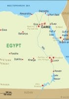
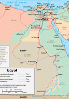
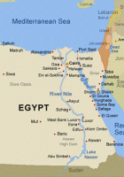
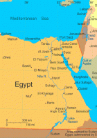
Egypt Maps: also known as the Arab Republic of Egypt, North Africa, after Nigeria 2 populous country. The majority of the population settled along the Nile River. Egypt, the Asian continent via the Sinai Peninsula in the northeast part of the borders of Palestine and Israel. Is a country in the Middle East is the cradle of civilization.
Explore map of Egypt, officially known as the Arab Republic of Egypt. It is a country located in North Africa. Egypt covers an area of about 1.001 million sq km (386,700 sq miles).
Egypt Maps
Recommend this page:
If you would like to recommend this Egypt Maps map page to a friend, or if you just want to send yourself a reminder, here is the easy way to do it.Simply fill in the e-mail address and name of the people you wish to tell about wpmap.org, your name and e-mail address (so they can reply to you with gracious thanks), and click the recommend button. The URL of this site will be included automatically. You may also enter an additional message that will be also included in the e-mail.